Thursday, May 26, 2011

Stopped by snowstorm, then on towards home...

May 26  - Spring Snowstorm Lake Tahoe

Parked on the Nevada side of Lake Tahoe for a lunch break yesterday, we watched the whitecaps form and dissolve into sprays of whispy foam as the waves collapsed.  A dark cloud cover was blowing in from the southwest and had already obliterated the Desolation Wilderness peaks normally visible from this pull-out.  We, on the other hand, were still basking in warm sunlight and for some reason did not care to properly anticipate the consequences of a delay on this side of Donner Summit. I knew that once over the summit, only chores and a return to "normal" life awaited and I for one, was in no rush to close this chapter of our delightful journey.

After a brief stop in Squaw Valley to visit with our friend Judy who resides there full time, we excused ourselves mid-Peru trekking slide show as the snow was beginning to accumulate in the trees and on the ground and we feared that the conditions might impact the Donner Summit crossing.  Driving away, leaving dark grey tracks in the unmarred snow, we checked in with CHP and as we suspected, confirmed the fact that Rt. 80 was closed to all except cars with chains or 4 wheel drive. An alternative plan for the evening was in order.  With mixed feelings, we contacted our friend Curtis who lives in Donner Memorial State Park to see if we might share a meal and park in his driveway to wait out the storm.  Feelings were mixed because we had really been looking forward to the open mic night at Tinker's Station in Soda Springs.  As always the gracious host, Curtis welcomed us over and we spent a great night in his and Sara's eclectic kitchen at one end of the mobile home they have anchored permanently tucked into the State Park cooking a pot luck macaroni melt and sharing camping stories along with hopes and dreams for the future.  The house is half living space, half recreational equipment storage locker, with kitchen cabinets as easily yielding a ski helmet and goggles as a macaroni strainer.  During dinner it stopped snowing but the temperature remained low so contrary to Curtis's prediction, our late spring snow cover remained in place and began to freeze into a more consolidated frosting.

This morning we awoke comfortably, as we had kept the cabin heater set to 50 to preclude the pipes freezing.  The skylights and windshield were obstructed by snow.  It is unbelievable to see the winter scene outside the camper compared to yesterdays balmy forest.  We check with the highway department and confirm the road is open, fire up the groggy turbo diesel, and point our nose west and over the summit.


From Spring-Summer 2011


Late May snowstorm traps us on the east side of Donner Summit for the night...


From Spring-Summer 2011


From Spring-Summer 2011


Yuba River near it's source below Van Norden Meadow...

From Spring-Summer 2011

Fledging Clark's Nutcrackers

May 25  on to the summit

We are awakened by the raucous calls of a juvenile Clark's Nutcracker with lots of wings fluttering and jostling in the nest we discovered just 50 feet from our campsite.  We are trying to figure out what is going on, when suddenly, with much inefficiency, one bird almost falls out of the nest, then flutters a few times and manages to latch on to an adjacent tree's branch.  Yelling and squeaking, it is now obvious to us this bird has never been away from his home limb before.  A second bird calls from the nest and shortly thereafter drops with a few meek flutters to the forest floor.  Now siblings call to one another, one stuck fearful on a strange limb above, the other hopping around on the ground trying to get his or her wings to operate like they imagined they should.  The pair continue this dance for an hour as we prepare breakfast and break camp. Now the parent birds fly a few loops over the pair compelling them to become airborne, and scan for threats to their vulnerable family.  A Steller's Jay forages a bit too close to the ground hopping juvenile and earns a scolding and low fly over from parent Clark. That appears to be enough of a warning and the Jay moves on.

Brief Movie of the action...


Fledgling Clark Nutcrackers on first foray out of the nest...

Tuesday, May 24, 2011

Buckeye Hotsprings

We awaken to a brisk morning camped at the end of the road in Big Pine Canyon. I creep out of bed and check the temperature outside. 35 degrees. As the sun creeps down the steep canyon walls towards our site, we sip steaming mugs of coffee and listen to the playful harmonies of the creek's traveling song. Scrub Jays visit our site in search of yesterday's scraps (there are none and he quickly moves on). North we drive today, up Route 395 with the glorious Sierra crest glistening to our left with a fresh layer of snow up high reflecting the sunshine through the clear desert air of the Owen's valley. The highway is surrounded by sage, but the Sierras rise rapidly to our west with almost no foothills. All the drainage access roads leading to the mountains go no further west than 8 or 9 miles before they terminate at the outlet to some mountain lake. Beyond that,another 1,500' of elevation gain brings you to the snow line around 8,500 feet. On this eastern facing aspect of the range, some open slopes are melted out, but the gullies, and couloirs are still choked with firm snow.

Up past Round Valley, Mammoth, June Lake, Lee Vining, Mono Lake, Virginia Lakes, we drive, finally stopping in Bridgeport to re-provision, check e-mail at the coffee house/bookstore behind the Galen Rowell Art Gallery. After a quick stop by the regional ranger station to check on road closures in the forest, we head up into the forest towards Twin Lakes,turning off on buckeye road, 7 miles from the highway in search of the Buckeye hot springs. This freshly graded dirt road leads up out of the valley scrub, and into a peaceful ponderosa pine forest. After crossing the bridge over Buckeye Creek, take the second right fork and head further up the hill. Stop at the off angle dirt parking area on your right 3/10 of a mile further. From here, we park the camper, grab our daypacks and clamber down the steep hillside leading down to the creek below. Just before the river's edge comes into view, and tucked along the rapids, just below a travertine bulge in the hillside, sits three steaming pools, separated from the stream by simple river rock walls. The water feels like around 106 degrees, and we undress and gingerly test the water. The spring floods scour the pool bottoms pretty throughly each season, and the locals appear to patch and repair the pool walls using river sediment at the beginning of the rubbing cycle. We have the pools all to ourselves this afternoon and it is truly magnificent to ease neck deep in warm water, looking up at the snow capped mountains and being literally at eye level in a rushing Sierra run-off stream. The adjacent rapids create a symphony of percussion, as different size stones are pushed down the mountain in the riverbed. As the water pours over one ledge to the next, and squeezes between tree roots, and over submerged logs, each transition generates a different frequency and tempo, the magical ensemble composing ever changing and mesmerizing river music. The hot water extracts the road strain from my psyche, and the tightness from my muscles. We sit at the edge of the medium warm pool, our feet soothed by the heat, and our skin cooled and tingling from the afternoon breeze flowing downhill with the river. Small birds skitter up stream looking for bugs. Late afternoon clouds begin to gather along the crest, and another bather appears from above. We exchange greetings, then depart to leave him to find his own peace in this magical spot.

This is by far our favorite eastern Sierra natural hot spring. There is plenty of free dry camping in the forest on the way to the spring before you reach the first bridge.

From Spring-Summer 2011

From Spring-Summer 2011

From Spring-Summer 2011

Big Pine

We are the only campers at the Big Pine Creek National Forest campground, nine miles west of the small town of Big Pine on Rt. 395, in a stand of large of Ponderosa Pines, right at tree line at 7,700 feet along the willow lined banks of Big Pine Creek, which is brimming with spring runoff snowmelt. The sandy soil all around is dry, but barely, and it looks like this year's massive snow pack has just recently retreated to higher elevations. The willows around the creek are just beginning to stand tall and bud. The aspens are just beginning to leaf, but it seems even too early for the first blooming snow flowers to emerge from the pine duff, and crushed granite. The large mature fir trees that surround this idylic spot are widely spaced, and the forest floor is a jumble of medium to large sized pieces of granite separated by a pine duff and small sage plants.

Only a portion of the campground is open, as the larger loop was virtually destroyed by a late spring avalanche. Trees of up to 18" in diameter were snapped at head height, picnic tables, crushed into match sticks, and heavy metal bear boxes, torn from their bolted foundations and tossed down the slope and into the creek. Amazingly, the concrete outhouses seem unscathed. Needless to say, there is a lot of clean up required before these sites will be habitable.

Today we hiked up the canyon, but were stopped by the snow line at around 8,500 feet after just over an hour of travel. Here on the east side of the Sierras, the elevation climbs quickly, and the 11,000 to 13,000 foot peaks of the crest beckon around every turn of the trail. This would be a great trailhead for spring skiing expeditions, as the road gets cleared early, usually mid April, and the trail head at the end of the road is quite high. There is a small family run summer only resort at the end of the road - Glacier Lodge for those needing an ice cream fix, a quick trout from the stocked trout pond, or some rustic cabin accommodations. The phone number is 760-938-2837, and they are on the web at Www.jewelofthesierra.com. There is also Glacier Pack Station near the end of the road 760-938-2538 where you can arrange a fully catered horse supported hiking or pack trip, or drop camp support to the high alpine lakes within one day's hike of the station. From this trail head, there are two primary hiking routes into the John Muir Wilderness, one following the north fork of Big Pine Creek, and the other following the south fork. Both trails rise above treelike quickly, following their respective watersheds through the broken granite terrain, and lead within a few miles to chains of pristine mountain lakes. The north fork has two waterfalls. Returning to camp for some quiet time, we dig out the sweaters and put away the shorts, because as the sun sinks below the ridge line, the temperature plummets back to the 50's. We are glad to have the camper and a comfortable place to get out of the elements.

From Spring-Summer 2011


From Spring-Summer 2011

From Spring-Summer 2011

From Spring-Summer 2011


Red Rocks State Park and Goodall Creek - Eastern Sierra

The cool katabatic winds are flowing down off the Sierra Crest snowfields this evening, caressing our campsite nestled behind a copse of bushes running along Goodale Creek, north of Independence in the eastern Sierra.  The change in temperature is a refreshing change from the hot and desicating winds of the southern California desert we left behind just this morning.

We camped last night at Red Rock Canyon State Park, off Route 14, northwest of Barstow, CA. This very large park is home to a population of desert tortise and contains many tall and colorful eroded rock escarpments dating back to older than the Sierras themselves.  Once the  sun went down and the temperature moderated, the black tailed rabbits, and cottontail rabbits came out to forrage.  We have modified our daily schedule to accomodate the climate, rising early for a sunrise outing, then resting in the shade or driving with the AC on for the hot mid-part of the day, then making another forray out later in the afternoon or early evening.  As we serendipitously wind our way back towards home, we are making stops as suits our fancy,or as recommended by fellow travelers. 

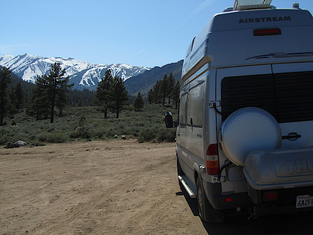
Today we had an interesting set of experiences at Fossil Falls, 2 miles south of the northbound rest area on 395 just north of where it joins 14, just south of the massive red cinder cone on the east side of the highway.  We had just pulled into the parking area at the end of a fairly short and passable dirt road, when a large SUV pulled in, loaded for bear, canoe on the top,towing a 25 foot shimmering airstream trailer. This parking area was way too small for such a rig, and there was no room to turn such a beast around.  We kept nibbling our sandwiches, as I was brewing some espresso, and watched the show, wondering how this driver was going to extricate themselves from this predicament. Next thing we heard a sickening scraping sound like aluminum against igneous rock, and the whole assembly came to a halt.  The driver got out inspecting the possible damage, walked around in circles for a few minutes, saw us and came over to request our assistance. She asked if we could spot the trailer as she tried to manuever it somehow off the rock she was impaled on, mid-trailer.  Having never manuvered such a large trailer before, I was not sure how much help I would be.  The most recent and relevant experience I had was managing the snowmobile and utility trailer at Royal Gorge all winter.

We discussed her predicament, and decided the only solution was to BACK the whole thing up the dirt road to a Y 1/10 mile away where there was more room.  She had almost no experience driving in reverse with the long trailer attached, so Diane positioned herself towards the back, and I stood about mid-ships, and tried to offer suggestions and direction as the motorized assembly began it's treacherous backwards journey up the dirt hill and around a series of tight turns. After a very promising start, things started going south, and after several failed attempts to correct the situation, we had a jack-knifed rig on a blind sharp curve, on a dirt steeply sloping road, one lane wide.  I did my best to use a calm voice and to tell the driver she ws doing fine, but she kept over turning and over compensating. Her confidence was shot and in exasperation, she asked if I could try.  Well, what could I do? In did not tell her about my snowmobile trailer resume,but agreed to change positions with her. She hoped out of the drivers seat, and I hoped in and was immediately affectionately licked by a huge black dog who had been concealed in the back seat.  I pulled forward, straightening everything out, then slowly began to back up,wracking my brain for any past experience or adventure story I had read which would offer me some insight on how to manage this situation.  I remembered reading something about doing everything backwards from what your intuition tells you, so I gave that a try, with Diane spotting the rear, and the owner spotting the blind side.  Fighting my urge to turn the wheel one way I experimented with turning it the "wrong" way as the rear began to deviate from the centerline of the narrow road.  Sure enough, the trailer obediently revered it's errant path, and curved back off the bank and onto the road.  Slowly, ever so slowly we worked our way backwards up the grade and around the curves,with just a few stops to force my brain to stay on task and working backwards, we made it into then"Y".  I got out, breathed a sigh of relief, bid our farewell  to the frazzled owner who sheepishly informed us she was at the very beginning of her solo trip to Alaska.   We wished her safe travels and ran back back to the camper, where we had left all the windows open, valuables out, and coffee simmering in our haste to respond to a call for assistance.  Diane quickly informed me she had turned off the coffee before we left abruptly, so disaster was averted.  

From Spring-Summer 2011

From Spring-Summer 2011


From Spring-Summer 2011


From Spring-Summer 2011

From Spring-Summer 2011

From Spring-Summer 2011

From Spring-Summer 2011

From Spring-Summer 2011

From Spring-Summer 2011

Desert Palm Oasis - Borrego sighting

May 20, 2011

It's very quiet this morning.  I awake thinking something is amiss, then realize it's just that the wind has stopped blowing.  For four days we have been buffeted by the incessent wind, only escaping it deep in a canyon hike, or nesstled securely in the protective fan palm trunks of a desert oasis.  I peer out the window at sunrise and see the creososte bushes still and calm, the tall blooming ocotillo stalks, spikes protecting the bright red flowers at the top, standing tall, anad unmoving.  This day looks to be a hot one here in the southern desert.

Anza Borrego Desert State Park is a van campers delight.  The rules here permit camping anywhere, and the fire ban precludes ugly firepits scattered about.  Anywhere we can drive, we can stop and camp.  The soil is mostly crushed granite and supports our weight, but then, without warning it can quickly change on these unmarked and undeveloped tracks to sand soft enough even to swollow up an entire wheel up to the axle.  We venture along cautiously, leaving the van parked, proceeding on foot as soon as the way looks dodgy. However, at least, this time of year, there are few other campers about and we have our secluded spots all to ourselves.  Yesterday, we hiked into the desert palm oasis and saw a roadrunner along the way. This dry wash winds up into the rigged hills, and then amazingly, a stream appears around a bend, with a necklace of green ferns lning its banks.  Still further upmcanyon large trunks begin to apear, washed down hill hybsome primoidial floods.  The large palm wood trunks seem to last forever in this climate.  The going gets a bit tougher as the trail gradient becomes steeper and turns to tallus and boulders, then around a corner, we are presented with a fine oasis of 80 foot fan palms denssly packed into the cleft at the bottom of the steep rocky intersecting slopes. One in the palm cluster, the temperature drops 20 degrees, and the wail of the desert wind is blocked, replaced by the trickle of the stream as it winds downhill right at the footnof the majestic stalks.  Birds flit about, making homes up and under the dense palm folliage clinging to the trunks, and in the acachia bushes circling the perimeter down lower.

On our way back down, along the "alternate" trail, we surprize a small herd of borregos, the alpha male tagged and collored, the females and juviniles grazing comfortably nearby.   The tagged and largest bighorn sheep kept a watchful eye on us as we stood frozen watching, and protectively moved between us and the herd as they moved as a group across the slope below us.

Once back in town, we stopped off at the town library (behind the mail mall) that conveniently has a wireless internet hub that reaches outside to the shaded benches.  While uploading my blog and photos, Diane stopped at the grocery store for provisions, and carried back two soft ice cream cones along with the bulging bags of dry goods.  Evreythng is quite close at this central hub of town. On our way out of town, we stopped off at the American Legion Post 852, and used their dump station to drain our tanks ($5), a real value these days. We were tempted to join the three friendly, but somewhat crusty desert rats cozied up to the dark bar at the post, but opted instead to drive west, and into the sunset in search of further adventures.


Thursday, May 19, 2011

Anza Borrego Desert State Park

May 16,2011

After studying the traffic patterns on the Internet, we strike out from Thousand Oaks to cross the LA basin on our way to Anza Borrego Desert State Park.  The freeways are like river white water, with obstacles, catch points, and channels of flow through the mash-up of cars, trucks , buses, delivery vans and tractor trailer rigs.  The GPS, like a reliable bowman, calls out the maneuvers, directing us to the proper lane and side of the road.  Left exits, right exits, forks, turns and straight away lane changes are all anticipated and executed as the electronically synthesized voice interprets it's database of intersecting vectors.  101 to 134 to 210 to 15 to 79 then we were finally released from the multiple-lane frenzy and deposited onto a two lane country road and climbed up and out of the basin over the sage and cactus covered hills to the rolling desert country beyond.  One ridge after another we crossed putting the southern californian sprawl far behind.  Tall billowing clouds piled up behind us and chased us into the growing desert.  The low angle sun now reaching under the storm clouds and illuminating the towering mountains which cradle the valley of Anza Borrego in their lap, we arrive at out first night's camp, boondocking in the Yaqai valley south of Borrego Springs.

The wind has grown boisterous and rocks the camper to and fro, as if we are anchored in an open seaway.  Different pitch whistles sing out as the turbocharged storm winds finds its way into the various gaskets, window cracks, and vents that connect our secure cocoon with the outside.  The sun sets, lighting up the eastern side of the valley, and turning the towering clouds into a pumpkin colored caldron of bubbling water vapor.  No sooner does the sun set, then the full moon rises, orange, and luminescent, seemingly right out of the fold in the valley floor directly adjacent to our secluded stopping place.  We make up the bed, put in earplugs to drown out the racket being made by the symphony of wind chimes the outside desert has become and settle in, rocked to sleep by the friendly nudges of unrestrained air rushing from the coast to some low pressure sump to our east.

May 18, 2011

We hiked yesterday to some pictographs, down a broad wash, to some overhanging boulders.  The drawings were nothing like I've seen before, with no representation of people, but more geometric designs, perhaps denoting passage of time, or directions to springs.  Again, we had the whole drainage to ourselves, and this helped in our emersion into this powerful and foreign place.  The soil is crushed granite, and there is no underbrush per se.  The plants emerge from the small stones in bunches, each protecting the other from the wind and the sun.  This area was seasonally visited several thousand years ago, by traveling bands of native peoples, to gather, dry, and grind Pinion nuts and to gather and prepare agave.  Evidence of these encampments is all over, evidenced by grinding stones and charred rock overhangs.  We see an occasional bird,but they are always shy, and rapidly depart.  Today we were treated to a sighting of a western tanenger, a bright yellow bird with a red cap about the size of a sparrow.  We explored a place called "The Slot", which is a very narrow wash, that turns into a mud walled slot canyon, with serpentine walls over 60 feet tall towering above a dry stream bed no wider than our hips.  Mid way through we crossed paths with another pair of hikers, the first we have seen during our whole visit here.  Tonight we are again boondocking - camped in the bush, not at an established site near a place called Yaqui Well.  The wind continues to blow, making the mid-60's temperature feel much colder.  The clouds are piled up high in the sky to our west, but they see to evaporate as they move east and overhead.

View pictures so far which appear belwow.


From Anza Borrego

From Anza Borrego

From Anza Borrego

From Anza Borrego

From Anza Borrego


From Anza Borrego

From Anza Borrego

From Anza Borrego

From Anza Borrego

From Anza Borrego

From Anza Borrego

From Anza Borrego

From Anza Borrego

From Anza Borrego

From Anza Borrego

Friday, May 13, 2011

Hike in Santa Monica mountains and visit to Everspring

From Spring-Summer 2011

Our hosts relaxing by the grotto at Everspring after work. Picture after that is from the Topanga banjo and fiddle competition, an amazing music fair held at Paramount Ranch near Thousand Oaks. Besides the main stage, where pros played between competitors, there was a whole music village to stroll through where ad hoc pick up groups played music on the street corners of the old movie set western town verandas. Booths were set up to sell guitars, banjos, and mandolins as well as straw hats, scarfs, and other folk music paraphernalia.


From Spring-Summer 2011

From Spring-Summer 2011


From Spring-Summer 2011


From Spring-Summer 2011

From Spring-Summer 2011

Wildflowers are all blooming. This is a refreshing change from the snowy confines of Donner Summit where we've spent the whole winter. We are using my brother's house as a base of operations as we explore this coastal region of southern California. The mediteranean climate is almost identical to Marin County near home, and it is easy to imagine ourselves far, far away looking over the uniformly red-tiled roofs and the multi-colored cascading hills rolling off to the distance. The trails here are already dusty and hot but the rugged terrain and tough plants are still enjoyable to ramble through. No single flower is large or showy unless you get real close and study the plants from a few inches away. On see exposed, dry slopes, the waxy leaved plants tend to grow like shrubs, with many blooms per plant. Lizards scurry just ahead of us on the trail, and there seems to be a steady buzzing from the busy pollinator insects in the shadows. At sunset we see a brown bunny cross the trail.

Hike up sandstone peak , the highest mountain in the Santa Monica Mountain Range. There was a thick marine layer on the coast, so we did not see the ocean, but the vistas were still remarkable...
From Spring-Summer 2011

From Spring-Summer 2011


From Spring-Summer 2011

From Spring-Summer 2011

Friday, May 6, 2011

Avoiding Toxic Produce | OnEarth Magazine

Just a quick reminder of simple things you can do to eat healthier.  Sure, it will cost a little more, but isn't your health worth it - think of the extra expenditure on food as an increase to your health insurance premium.   Avoiding Toxic Produce | OnEarth Magazine

Monday, May 2, 2011

Last ski day of the season - Creamy cruisers


Before we dismantle the mountain safety equipment for the season the patrol gets a few hours to ski on the fine spring conditions.