Saturday, October 25, 2008

2008 Oct 25 - Mount Judah

Sunset from the flank of Mt Judah looking north towards Castle Peak. One last weekend before the snow covers it all.

Clawing tree roots grasped to take hold, find water, and survive the harsh winters on this exposed slope above the north fork of the American River near Royal Gorge.

Fall colors looking south towards White Peak and the Royal Gorge of the American River.

Snow squalls over lake Tahoe.

Thursday, October 9, 2008

2008_Oct 9 - Las Vegas to Topaz Lake, CA

(Click on any image to enlarge it)
Diane says... can I come out too?

Camped at Red Rock Canyon BLM campground 30 minutes from Las Vegas


There is a great scenic drive here - terrific for bike riding, then there are spur hiking trails off into the side canyons. Come back here in the spring or fall for at least 3-4 days of activity.

Harvey by the red rocks


View on to the Sierras from the White Mountains in Nevada- back in California at last

The Sierras as we drive out of the Whites...

How we ever gonna get over these things... (from 395)

Wednesday, October 8, 2008

2008_Oct 8 - Grand Canyon to Red Rock Canyon, NV (Las Vegas)

Sunrise at the the south rim

Moon over Joshua Trees


Long evening shadows in the Las Vegas desert


Diane works on the maps and plans tomorrows adventure.


Sunset glow in Nevada desert


Open this one bigger to see the big dipper...

Tuesday, October 7, 2008

2008_Oct 7 Kaibab Trail - Grand Canyon

Imagine a blue, pure blue, deep blue, that seems to go on and on like an ocean – unobstructed by tree, or cloud, or contrail, or airplane, or anything. A blue so rich and pure, there is no variation in its depth or hue no matter what direction you look. This is the sky today over the Grand Canyon. The north rim, 10 miles ahead of us as the raven flies is flat across the top – very flat, so as the sky washes up on the horizon with barely a ripple.

Now, imagine a quiet, a pure silence. The silence of the ages, of timeless time spanning backwards beyond your imagination. The vacuum and absence of sound, the void of only atmospheric gasses applying their partial pressures to one another in equilibrium. The silence of no cars and no busses and no train whistles forlorn and far away. No sound from running water or babbling brook. No sand blowing across rock face, no tumbling pebbles down a steep wash, no footsteps on the gravel ledge.

Just our calm breathing and twitch of body heat evaporating in the high desert air. We’re resting now, trying to be absorbed in the essence of this vast canyon, on an eroded rib of a fluted shoulder of slightly harder rock than what has been washed away on each side by time on the Kaibab trail which leads from the south rim to the Colorado river, more than 5,000 feet below.

As we gaze into the maw of time laid out in front of us, a raven’s wingtip feathers whistle slightly as it glides by not 10 feet away out in the pillow of air that lifts him skyward. A whoop, whoop whoop of low frequency and mystical timelessness, lifts his body a bit and he is gone around the next rib. Was he really there, or just a spirit of the canyon slipping into our consciousness?

And then, far below but along the same rib we can see the dust swirling above the trail, and around the corner a string of mules appears, lead by a dusty ranger, the same color as the trail. A slow plodding caravan of sweating, committed beasts. No need to look upward as they clomp – their footsteps will eventually lead to the rim, and a rest, but until then, just one step at a time. The trip up from the depths takes all day, from 5:00 am to after 3:00pm. The re-supply caravan travels once per week to the Phantom Ranch, at the cold river’s edge far below.

Sitting in the balmy air after sunset, we watch as the stars make their appearance from behind the daylight scrim that conceals them. Introduced by the ½ moon, then the planets, and finally the crowd of glittering diamonds of stars – only forming into recognizable patterns as my mind reaches back to recall diagrams crudely estimating the geometric arrangements of the clusters. The blue of this afternoon’s sky has been transformed into black, with the void lit by a cacophony of stars – crowding each other out for my attention, hiding the bright ones that usually get all the glory. A shooting star appears to our left and races across a quarter of the sky before being extinguished by the competition of other stars.

If you go:
Bring plenty of water and energy food
walking sticks
leave very early, or very late and bring a flashlight
covering for your head and extremities
good, well tested walking shoes
enough time so you are not rushed while hiking
Leave time to view the iMax movie just south of the park

Early morning visitor to our campsite

Looking north west from the south rim


The first level down from the rim - the trail follows narrow ledges down such a face before following a more gradual ridge below.


The Kaibab trail follows a ridge line down most of the way - unlike the other canyon trails which are mostly in deep gullies and slot canyons created by streams.


Monday, October 6, 2008

2008_Oct 6 2008 arrival at the south rim of the Grand Canyon


Across Arizona

Up into Canyon Country

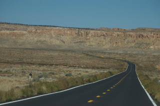
Looks like Tibet... but its Arizona

At last, at the south Rim...


Big elk, very accustomed to people, nibbles on the watered lawn in front of one of the lodges.

Sunday, October 5, 2008

October 5 2008 - Gallup, New Mexico

Last night we spent in Amarillo, Texas, after a long drive across the rest of Oklahoma, and the northern panhandle of Texas. We opted for the first KOA Campground of the trip, and were rewarded with hot showers, laundry facilities, wi-fi connection, and a pizza delivered right to our camper. Talk about “glamping” (glamor camping). A heavy rain storm passed over head for several hours, shaking us on the suspension all night and whistling the skylight gaskets. In the morning, the rain had reduced to a sprinkling and we were rewarded with a view of a coyote chasing after rodents in the tall grass adjacent to our parking spot.

Thinking back to Oklahoma (which occupied me for most of yesterday) my biggest impression and distinction from Arkansas, was that the landscape has now flattened out and opened. The trees, where there are any are short and scraggly, and well beaten down by the incessant wind across these southern plains. The soil is now a deep red where it is exposed, rather than the dark brown of the eastern states.

Night before last, camped on the shores of Brushy State Park(pictures at end of yesterday's post), in Oklahoma just north of Sallisaw, we walked at dusk and were amused by the fire flys in the cut grass around our site. They were just the prelude to an amazing night of weather pyrotechnics as a massive thunder and lightening storm tracked just a few miles south of us. I determined this by counting the seconds between the amazing sky flashes and the almost deafening crashes of the thunderclaps. Even though we had the shades pulled tight, the light from the crackling lightening was bright enough to shine through the cracks at the edges of the windows and illuminate the inside of the camper. At first, we gave up all hopes for sleep and lay awake looking at the ceiling, bracing knees against the shaking canopy and letting out ooohs and ahhs after each spectacular sky borne crescendo. Eventually, we covered our heads with a pillow and must have fallen asleep.

The winds today on the eastern plains of New Mexico have picked up and buffet us as we roar down the road. We’ve topped off fuel and water tanks to compress the springs so they are stiffer against the push of the sideswiping gusts. We are traveling west on route 40, the replacement highway for historic route 66. In places we travel right alongside the old roadway, and in other places we can see where the quaint 2 lane ribbon it has been completely obliterated by the runway like expanse of the new thoroughfare. Here the towns are spread far apart and most travelers on the road are in it for the long haul. Old abandoned intersections can be seen just off the roadway, with stark and isolated structures reflecting the classic lines of an enamel tilled filling station and old style rusting pumps out front. Rusted signs swing off kilter in the wind, pot marked with bullet holes from some adolescent’s boredom. The brush has pushed up through the cracks in the pavement softening the demarcation between dry prairie and roadway. Dried, caked and cracking mud holes fill the depressions with bunch grass in front of the abandoned stations where countless traveler’s of years past have rolled in, checked oil, washed windshields and filled their tanks.

Whosh, another tandem UPS truck rolls by, followed in just a few feet by some rumbling behemoth carrying some obscure piece of mechanical equipment barely narrow enough to conform to width restrictions. License plates on the trucks reflect a wide diversity of sources for the loads heading west. The rain, which we had left behind in Texas has caught up with us so we drive in an incessant bombardment of sound from rain, windshield wipers, and wind whistling in the door gaskets. We are absorbed with the vast landscape and the very physical way in which we are pushing our way through it. The roadway has sections of 10-15 mile straight always, rolling slightly over the chaparral with low bridges over the sharp walled washes that tell of sudden, but inconsistent precipitation. Occasionally, a broken sage brush tumbles by pushed by a gust of wind.

(Click on any picture to enlarge it)

The view down Route 66 - west of Albuquerque, NM

About as much of the continental divide as we saw - all water from here drains to the Pacific!!

Mesa Land in New Mexico


Outside Gallup, NM


What's this she asks?


On to the Grand Canyon tomorrow...