Showing posts with label backcountry skiing. Show all posts

Thursday, December 13, 2012

Castle Peak with Jeff and Dave

The morning broke clear and cold, with temperatures at the house near 10 deg. F when Jeff picked me up around 8:45 and we drove one exit up the highway to the rest area off Rt. 80 on Donner Summit and headed north onto the southern slopes of Castle Peak. The snow was in great condition, although somewhat thin, and undulating terrain normally buried by blowing and drifting snow was a challenge for route selection.  Dave met us at the parking area providing crunchy chocolate chip cookies as morning fuel for our endeavor.  The night air had been very still and very clear, so a thick mat of surface hoar covered the slope, reflecting the bright sunlight back to us like a million diamonds.


Just before our lunch break, the weather become more unsettled and a thick cloud bank rolled in from the south


The trip back to the car was complicated by a series of stream crossings. Jeff led us expertly to thin snow bridges which we crossed with haste before they became saturated with the flowing water beneath.


Tuesday, April 10, 2012

Castle Peak with Three Daves and a Bob

From 2012
Matzo fueled quartet of Three Daves and a Bob heads up the southeast aspect of Castle Peak for some fine spring corn snow skiing.  We all met early at the Donner Pass Rest area off Rout 80 ( 7.280 feet) on the Westbound side, and followed the ridge line up to near the summit where the steep rocks stopped us.

The views down into the Euer Valley to the east and the Sierra crest to the south were a fine reward.  The weather held off and we peeled off two great runs before the snow softened and we glided back on a perfect trajectory and slid all the way to the cars finishing around lunchtime.

The Squaw patrol crew gearing up at the rest area - temps already in the high 30's at 8:30am. Dave, Bob, and Dave

From 2012

Climbing starts within a few minutes of leaving the car.  A firm surface and open terrain make the going smooth and fast. Route finding was a breeze.


From 2012

You can see snow is thin on the true south aspect, but where we are going, coverage is fine.


From 2012


Devil's Peak to the southwest as Bob skins steadily upwards.


From 2012


Bob and Dave discussing higher math concepts... you know you are hiking at the right pace if you can carry on a conversation while climbing....alright- they were not discussing math...


From 2012


Dave approaching the shoulder (8,800 feet) for a well deserved water and snack break. Tinker's Knob and Mt. Anderson in the distance.  Second run we launched from the rounded knob right behind Dave in this picture.


From 2012


Dave is saying... I guess this is the top... I ran out of snow. (8,731 feet) the precipitous eastern face of Castle Peak looms ahead, with a nice steep slope to our right.  A crew earlier had used a snow machine to do laps up to the top here coming in from Negro Canyon. Luckily, they went down a different way than we did, so we had no need to look out for there tracks.  Basin Peak in the distance beyond Castle Peak.  From here there are ski routes down on almost every aspect.


From 2012


Transition and a snack before skiing down....


From 2012


"Turbo" Dave sweeping big GS turns on a thin layer of corn...


From 2012


Bob heading back up for another lap.  Our second run came down off the shoulder in this photo, traversing around to the big rock on the looker's left. and down that ridge back to the highway far below.


From 2012


Dave, readying for the 2nd lap down off the shoulder.  What a view out across the Martis Valley all the way to Mt. Rose. Still thinking about that chicken liver from last week.....


From 2012


Putting the skins away - whose grandmother makes the best......what was that - chicken wontons?


From 2012


Hold me back...can I go now? huh? huh? Put that camera away and lets S K I !!


From 2012


"Turbo" swoops in on the next drop...


From 2012


Let's see, another lap or a milk shake in Truckee.....guess we'll head for the car.  That's Castle Peak behind us.


From 2012


Wednesday, April 4, 2012

East Side Mt. Judah - Backcountry skiing with Jeff

Yesterday it was 50 degrees and the snow surface had turned to cement and pudding. Last night the temperatures dropped fast, it was mostly a clear night and the snowpack consolidated and froze up - then miraculously, 4" of fresh, light powder appeared by morning.  The wind was howling over the ridges, but just below on the south east aspects, the air was calm, and the skiing was superb.  Apparently no one else got the memo, because Jeff and I had the backcountry side of Mt. Judah all to ourselves and repeated our run from the summit ridge 5 times with fresh lines each time, following the Judah loop trail down to the resort's base to catch a lift up to the top to repeat the fun.  Last run we did a modified Lake Run and found a steep chute leading to a break in the train shed that led us down to the wooded basin below the cliffed side of Donner Peak.  We climbed up to the train shed and back to Donner pass and finally hitched a ride back to the resort.  Wow!!!

From 2012


Skiers dropping into Judah's East face in the Sugarbowl backcountry...


From 2012


Creamy fresh snow on an untouched slope.  We managed 5 runs on this slope with no other skiers today... amazing.


From 2012


From 2012


From 2012

Wind howling over the summit - glad we could duck out of it just over the lip.

From 2012


From 2012


After an day of skiing we had completed 5 runs on the back of Judah - with no other skiers...These are all our tracks.

From 2012

Deciding on where to drop in next...


From 2012


From 2012


From 2012

Skiing on north east side of Donner Peak

From 2012

Can you find Waldo?  Look top of looker's left chute.  This chute drops right to a break in the train shed leaving a clear path with no major gaps all the way to the streambed.

From 2012

Climbed back up to the shed to find a way back to Donner Pass.


From 2012


From 2012

Monday, March 28, 2011

Climb up Jakes Peak, and along its North Ridge

Never a bad view, while resting on the way up Jakes from the DL Bliss State Park winter parking area...
From Jakes, first REAL day of spring
Once on the summit, we toured north along the ridge, with great view to the southwest of Desolaiton Wilderness, and to the east and north of Lake Tahoe.  Our route down was in the open chutes just left of center in these photo.

From Jakes, first REAL day of spring
We skied slowly across the ridge, picking our way over wind gullies and enjoying the stupendous weather and scenery in all directions.  Amazingly, we saw some small animal tracks right on the ridge, very well preserved in the firm snow.

From Jakes, first REAL day of spring

From Jakes, first REAL day of spring
Looking for the perfect lunch perch, we ascended this roll along the ridge so we could see both ways, and be protected from the wind.

From Jakes, first REAL day of spring


Here is a short (1.5 minute movie) from the top...I wish I had filmed more.


Drive down to the west shore of Lake Tahoe to the DL Bliss State Park parking lot and tour along the north ridge of Jake's Peak. The copious snowpack was wind beaten, and soggy, but the views were amazing.

Monday, March 21, 2011

North Maggies with Jeff

From 2010-2011 Serene Road house
Emerald Bay, with North Maggies at the head - photo curtesy Stone Tire in Truckee - (see next post for explanation of why I was at Stone Tire). We skied the south east shoulder and then down the left edge of the big avi chute just above the road...

From 2010-2011 Serene Road house

We drive to the end of the plowed road (Route 89) and break trail to the usual trailhead for North Maggies - having Emerald Bay all to ourselves with plenty of time to study the ski lines off Jakes and Maggies, and to enjoy the view out over Lake Tahoe without being pestered by cars racing bay. You can see the skier on the unplowed road on the right side of the photo above.

From 2010-2011 Serene Road house

From 2010-2011 Serene Road house

After a 4 hour slog up through the deep snow, we enjoy an incredible ski down through the massive Sugar pines and champagne blower snow - using the edge of an old avi chute for a great guide back to the uptrack far below.

From 2010-2011 Serene Road house

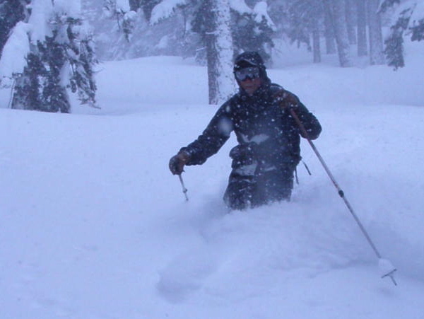
This cloud of snow has a skier just on the left edge. If his face was not obscured by so much snow, you'd see a big grin.

Watch a 2.5 minute video...

Drive down to the west shore of Lake Tahoe to the end of the plowed road at Emerald Bay and share this climb up North Maggies Peak on stormy day. Our 5 hour tromp through fresh snow is compressed to a 2.5 minute video for your enjoyment